

Global Mapper Download For Windows 23.0

349 MB (Safe & Secure)
Global Mapper is a powerful GIS software for PC that will enable users to handle multiple specific formats, perform complex analysis processes, create map layouts, or even deal with LiDAR data.
Now in its third decade of development, Global Mapper continues to cause a stir in the worldwide geospatial community. From its humble beginnings as a simple data viewing utility, it has evolved into a major player in the GIS software industry boasting an unrivaled collection of data creating, editing, rendering, and analysis tools at an affordable price, right out of the box. This software is helping to expand access to GIS technology by dismantling the cost and usability barriers inherent in traditional GIS applications.
Equally well suited as a standalone spatial data management tool and as an integral component of an enterprise-wide GIS, The program is a must-have for anyone who works with maps or spatial data. The app is more than just a utility; it offers a surprisingly extensive collection of analysis and data processing tools in a truly affordable package. Providing support for virtually every known spatial file format as well as direct access to common spatial databases, this remarkable application can read, write, and analyze virtually all spatial data.
This is an intuitive user interface and logical layout help smooth the learning curve and ensures that users will be up-and-running in no time. Companies and organizations of any size will quickly see a significant return on investment brought about by efficient data processing, accurate map creation, and optimized spatial data management.
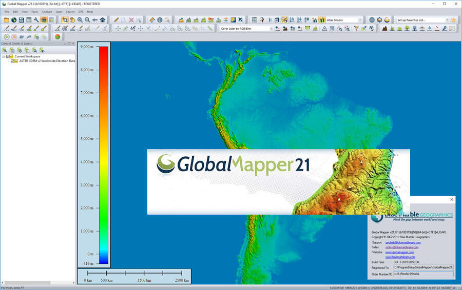
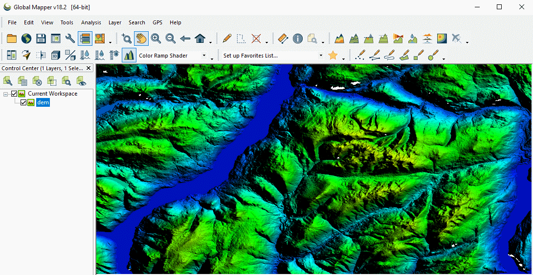
With a particular emphasis on terrain and 3D data processing, Global Mapper‘s out-of-the-box analysis functions include view shed and line-of site modeling, watershed delineation, volume measurement, and cut and fill optimization, raster calculation, customized griding, and terrain creation, contour generation, and much more. Complementing this core functionality, the optional LiDAR Module provides a wide array of point cloud processing tools including automatic point classification, feature extraction, and the powerful Pixels-to-Points tool for photogrammetric point cloud creation.
Complementing these powerful analysis tools is the Mapper includes a complete suite of raster and vector data creation and editing functions offering everything from simple and intuitive drawing to image rectification and vectorization. The software also includes numerous attribute editing functions as well as intuitive data display and thematic mapping capabilities.
When the time comes to share map data, It offers numerous options including eye-catching page layout and printing tools, geospatial PDF creation, and direct web publishing to MangoMap, an affordable and easy-to-use online map service.
The user interface may seem a bit overwhelming at first glance, but this is only because the application comes packed with many dedicated features. In order to make the most out of every single built-in tool, users are advised to refer to the in-depth documentation.
This software offers support for a wide range of data formats: GeoPDF, DLG, DRG, DOQ, DEM, DGN, DTED, DWG, DXF, GPX, SDTS DEM, ECW, GRD, JPEG, CADRG/CIB, KML/KMZ and it also thoroughly implements LiDAR functionality.
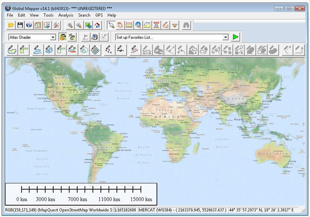
Users are met with four main operations, namely to open data files, download data from online sources, configure the program settings, or load sample data.
Global Mapper GIS Software Features
- Flexible View Interface: The new multi-view map display allows several docked map windows to be displayed within the interface for better data visualization and manipulation.
- Global Energy Mapper: Global Energy Mapper (GEM) functionality is now included in the base product of the app.
- Feature Extension Plugin Support: These allow 3rd-parties and customers to create add-ins to Global Mapper to extend the functionality through their own toolbars and/or menu items.
- 3D Data: It works as easily with 3D data as it does 2D data.
- Data Importing/Exporting: One of the unique and defining characteristics of Global Mapper is its extensive and varied data format support.
- Spatial Database Support: Import and export data from your spatial databases.
- LiDAR Point Clouds: View and process point files with a billion points or more.
- Access to Online Data: With many data GIS administrators choosing to distribute data through web-based services instead of offering file downloads or disk media, there is now a vast quantity of readily available spatial data just a mouse click away.
- Google Earth Support: It has built-in support for importing and exporting data in Google’s KML/KMZ format.
- Image Rectification: A standard function of Global Mapper is its ability to import virtually any image file and to create a geographically aligned and scaled raster layer.
- Geocoding: It includes a powerful geocoding function that allows real-world coordinates to be assigned to an imported database of addresses.
- Graph and Chart Manager: The Graph and Chart Manager allows the user to create graphs and charts from loaded data.
- Digitizing: As well as offering unrivaled access to preexisting spatial datasets, It provides a vast array of digitizing tools for creating and/or editing features on the map.
- Feature Rendering: It offers limitless possibilities for assigning specific visual characteristics to vector features on the map.
- Map Printing and Web Publishing: When it comes time to share your maps or data, It offers many output choices.
- Raster Calculator: The Raster Calculator found under the Analysis menu can be used for performing mathematical operations on multi-band imagery to extract different types of information.
It enables users to zoom in or out of the map, preview the data in 3D, select a background color, draw and measure segments/areas, select the vector features (areas, lines, and points), view loaded elevation datasets and perform a line of sight calculations, and much more.
Additionally, there are several tools designed to help you create an elevation grid from 3D vector data, combine or compare terrain layers, generate contours and watersheds, find ridgelines, and measure volume between surfaces.
Other important features worth mentioning allow users to activate the GPS function, mark the waypoints, as well as select new areas on the map and modify their features in terms of type (e.g. sands, watersheds, wooded area, lakes, islands, reservations), name, and distance.
The generated data can be exported to a multitude of file formats, namely PDF, JPG, PCX, PNG, RAW, KML/KMZ, DXF, SVG, and others.
Global Mapper is a reliable application that bundles many useful features for helping you manage GIS data efficiently. It is suitable especially for those who are looking for a powerful GIS suite to meet their requirements and who deal with consistent geographical datasets.
Global Mapper Software FAQs
Why is the Lidar Module being replaced?
When the Lidar Module was first introduced, it focused entirely on editing and analyzing lidar and point cloud data. As the tools in this module evolved the Lidar Module started to expand beyond lidar data editing. Transitioning from the Lidar Module to Global Mapper Pro allows our teams to expand the advanced tools available beyond lidar and point cloud processing to other areas of analysis and work, like automatic breakline extraction and python script integration.
Is Global Mapper Pro a separate program download?
Global Mapper v23 and Global Mapper Pro will be downloaded and installed from the same executable installer file. The licenses or order number applied will then unlock the appropriate program functionality. Similar to the structure of licensing with Global Mapper and the Lidar Module, users who would like to access Pro features will need to have a Global Mapper v23 and a Pro license.
Is Global Mapper supported on remote desktop?
Remote desktop access is not supported with a single user machine locked or dongle license. It is possible to use a network license to access Global Mapper via remote desktop.
How do I change the projection that I’m viewing my data in?
The current workspace projection can be modified on the Projection tab of the Configuration dialog. You can access the Configuration dialog either from the toolbar or under the Tools menu. Data imported to and exported from the workspace will assume the new projection.
System Requirements
| Operating System | Windows 7/8/10 |
| Memory | 1 GB RAM. |
| Storage Space | 320 MB Free Hard Disk Space. |
Official Video Intro Global Mapper Software
- QGIS
- GRASS GIS
- ArcGIS
- what3words
- MapWindow GIS
- gvSIG Desktop
Global Mapper Software Overview

Technical Specification
| Version | 23.0 |
| File Size | 349 MB |
| Languages | English, Italian, French, Spanish, Polish, Chinese, German, Japanese |
| License | Free Trial |
| Developer | Blue Marble Geographics. |
ad
Comments are closed.